Skip to content

The Cieplice Green Walking Loop

A 6.4 km loop around Cieplice that gains 37 metres over the whole walk – about as much as the steps onto the flood embankment and a few rises in the park. It is a circuit, so you join it wherever you like. It runs through both spa parks, along the Kamienna and down a historic oak-and-maple avenue, crossing the Wrzosówka and the Podgórna on the way.

Careful: two different trails share one waymark

Cieplice has two walking trails marked with the same white-and-green square, several kilometres apart and with nothing to do with each other. This page is about the loop around the spa quarter. The other green one leads to the Grave of the Unknown Priest: 2.1 km point to point, climbing all the way, ending in the forest above Staniszów. A regional green PTTK trail from Cieplice through Staniszów to Karpniki also runs nearby – it carries a different waymark (a plain stripe, not a square), but on a map the colour is the same.

What you pass

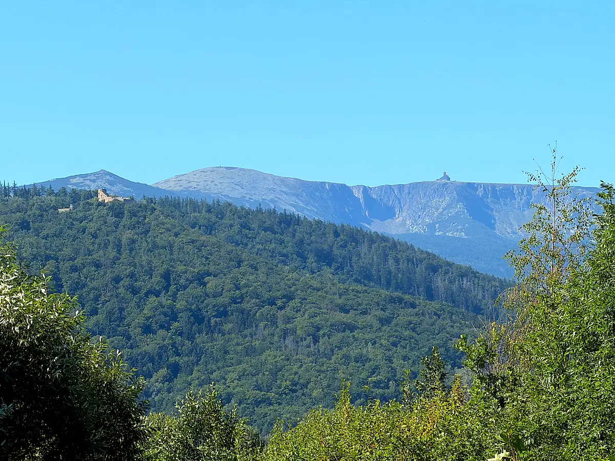
From Plac Piastowski the trail follows the Kamienna, passes the Long House and the figure of Saint John of Nepomuk, then leaves the spa along Tabaki street into open fields. After not quite two kilometres steps take you up onto the dam crest, and beyond it opens the view of the Karkonosze with Chojnik Castle in the foreground.

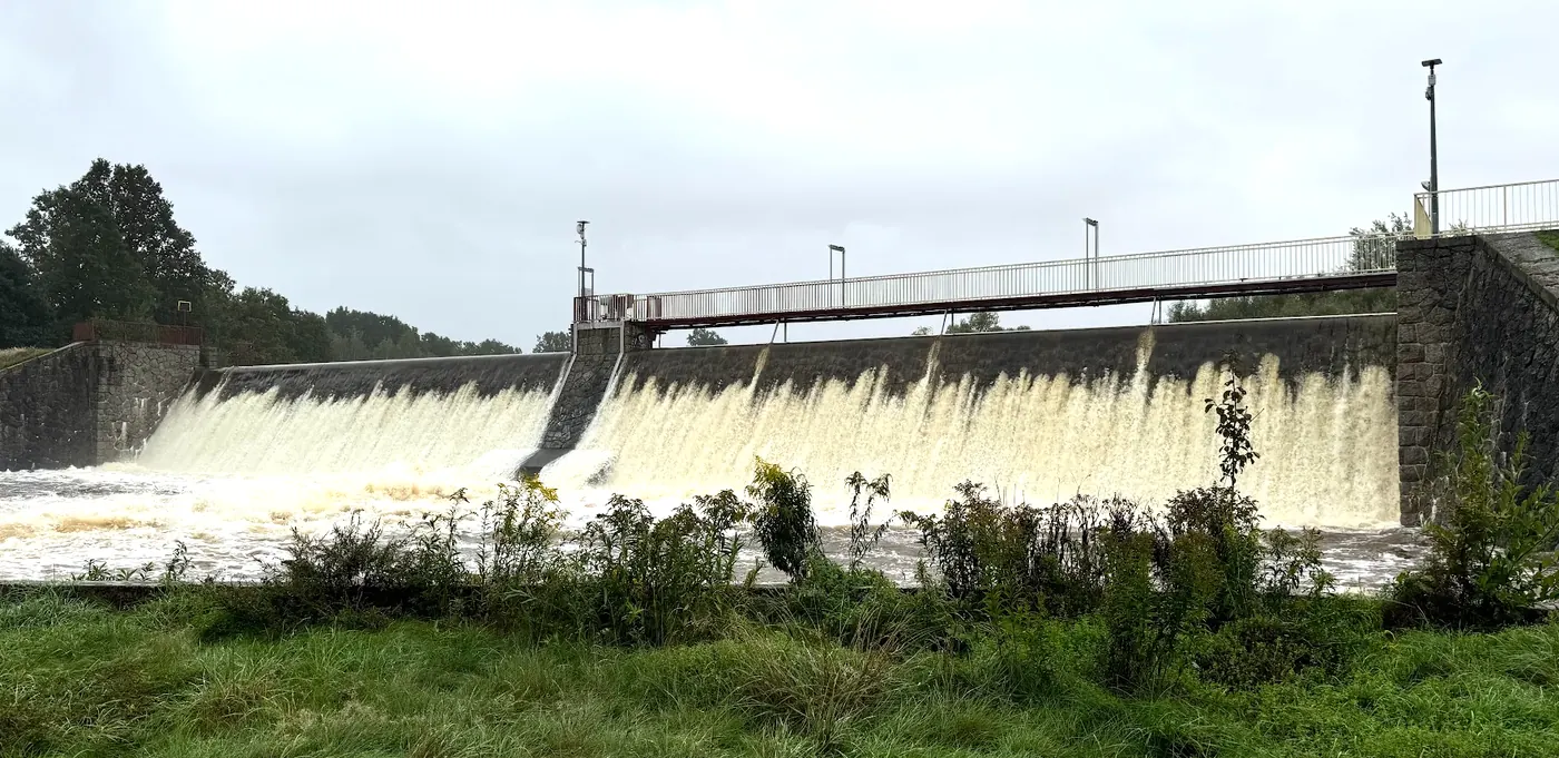
This is no ordinary embankment. You are walking along the dam of the “Cieplice” dry flood-control reservoir – an early twentieth-century structure built after the great flood of 1897 and listed in the heritage records. The reservoir stands empty most of the time: its floor is meadows and rough grassland, and it only takes in the Wrzosówka and the Podgórna when there is too much water. It last filled on 14 and 15 September 2024, when water poured over the whole length of the spillway and the reservoir passed its alarm level. That flood was bigger here than the one in 1997. The dam is about 1.3 km long and its crest, at 345 m above sea level, has been a promenade for spa guests for over a century – this is where you look out at the Karkonosze. When it does fill, locals call it “Lake Cieplice”.

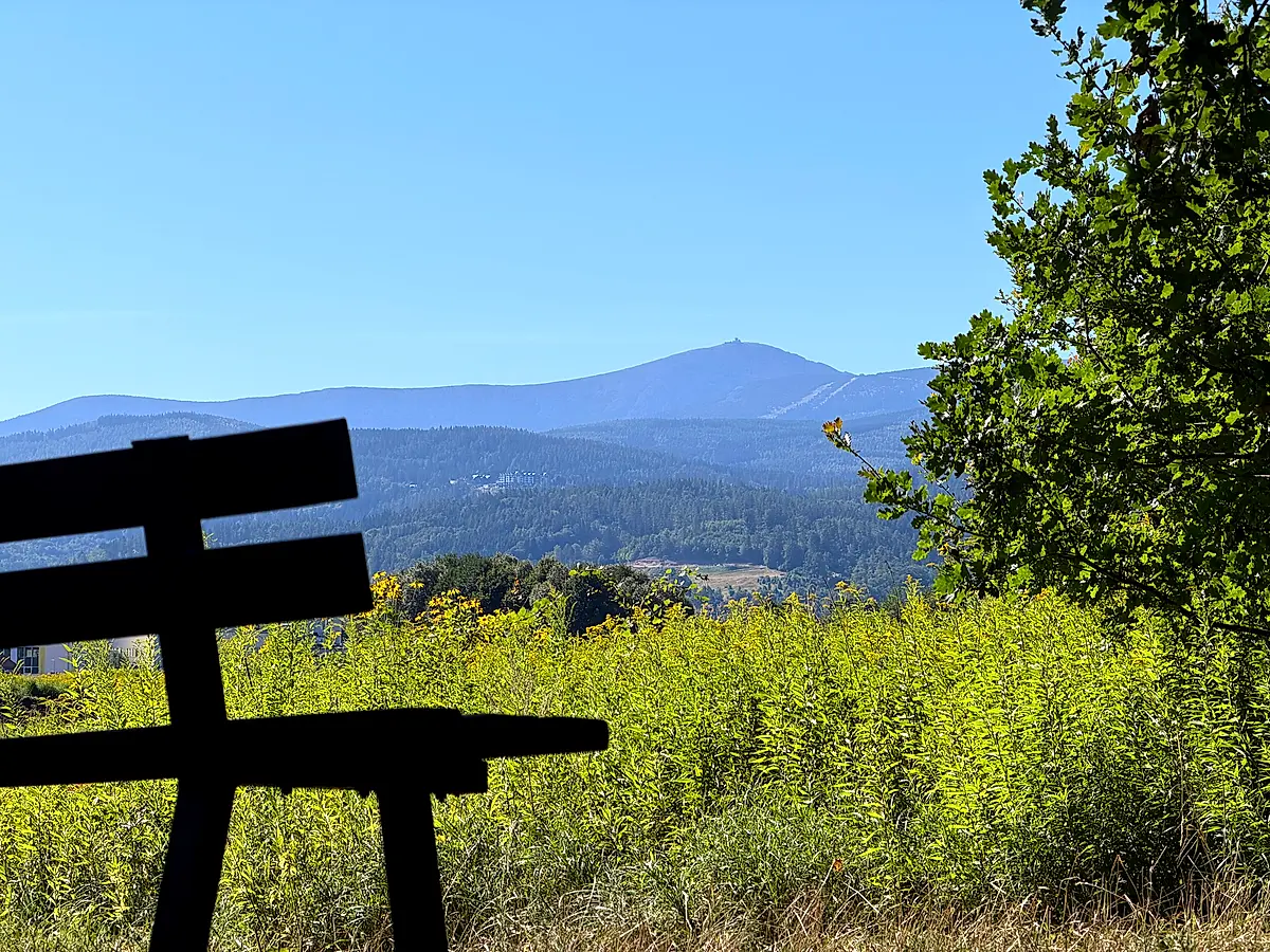
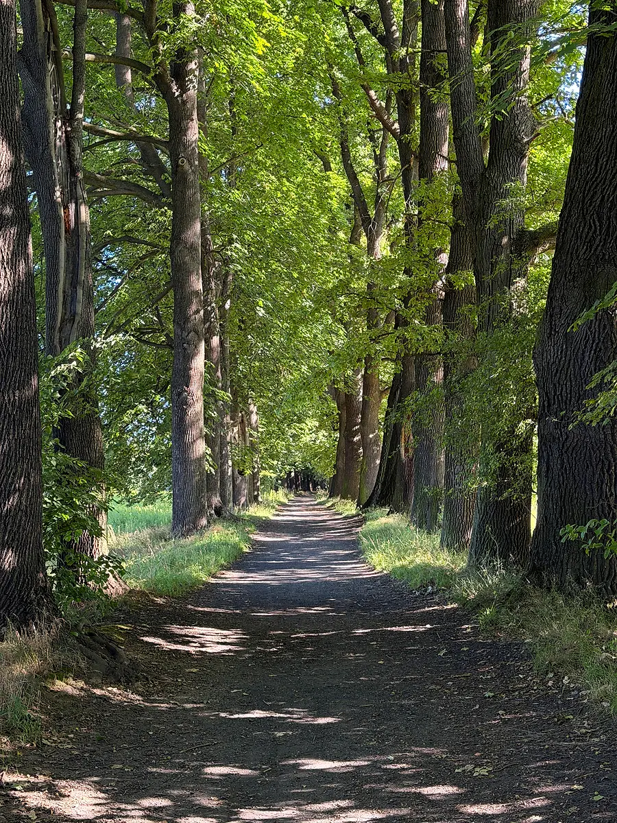
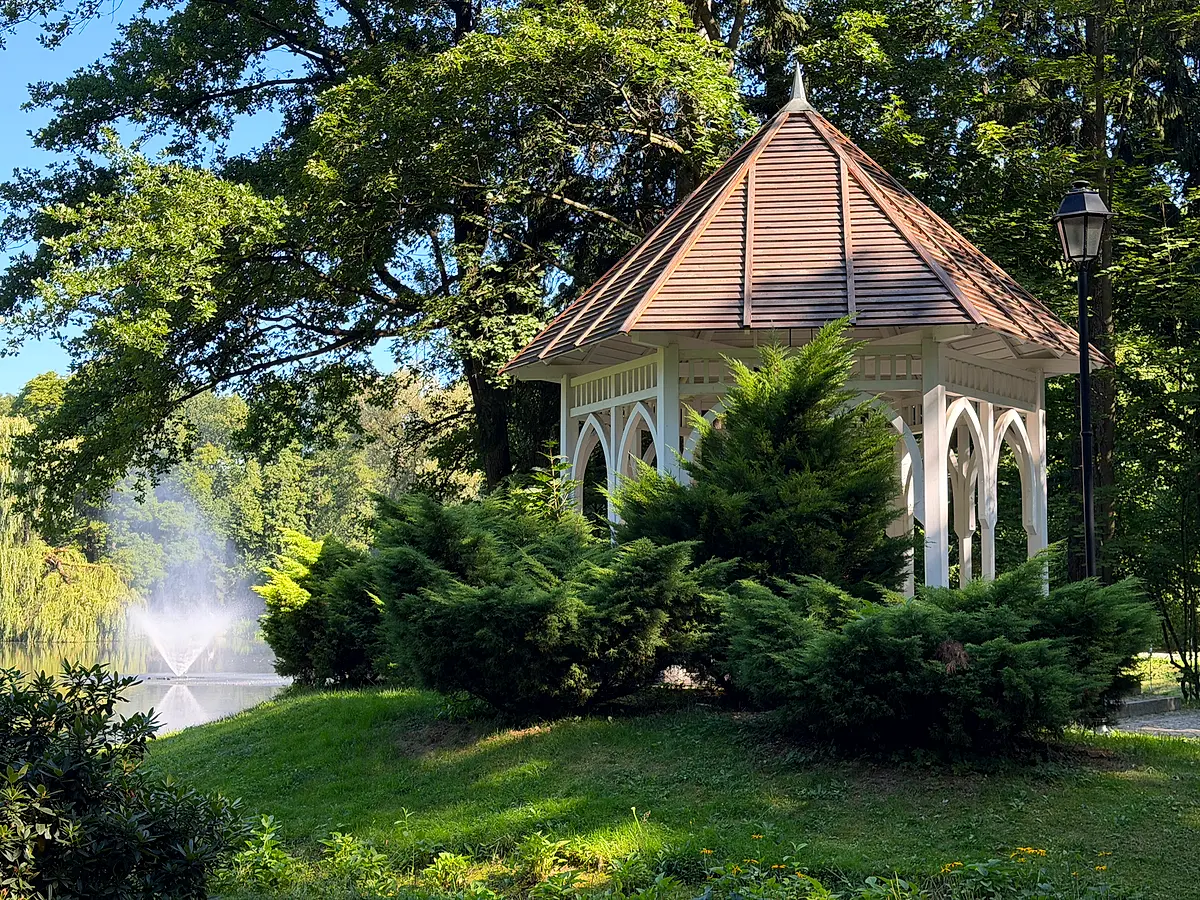
The route then leaves the embankment, crosses over the Podgórna, passes a bench facing the mountains and enters the historic oak-and-maple avenue – 135 trees, a protected natural monument. The way back leads through the Norwegian Park and the Spa Park, past the Holy Family chapel, and ends at the Schaffgotsch Palace, facing the church clock tower.

Waymarking – the weak point

The green loop has no signposts – none of the boards naming the next point and its distance that stand along the red loop. All you get is the painted waymark, and in a few places it is faint or easy to miss. Glance at the map from time to time – in the app the trail is guided by voice and tells you when you have left it.

Little deer on the way

Walking the loop you pass two figurines: Ciepliczanka i Zdrój in front of the Schaffgotsch Palace and Lalkarz by the Puppet Theatre. A third one, Rzemiosław, sits just under two hundred metres away – a short detour is enough to collect it. All of it on the flat, without a single climb.

Can I do it with a pram?

Yes – with one caveat. Steps lead up onto the embankment, but they can be bypassed at the cost of a few dozen metres. Otherwise it is park paths, pavements and field tracks, so a pram and older legs will manage. The field sections soften after rain.
Key facts

Length6.41 km (a loop)
Total ascentabout 37 m
Elevation342–350 m
Time1 h 40 min at an easy pace
Startanywhere on the loop
Waymarkwhite-and-green square
Surfacepark paths, field tracks, about 1.2 km on streets
Zapora suchego zbiornika Cieplice podczas powodzi 15 września 2024: woda przelewa się przez całą długość kamiennego przelewu
15 September 2024. The reservoir whose floor you normally walk past on dry ground, working at full stretch – water pouring over the entire spillway crest.

Photographs from the route

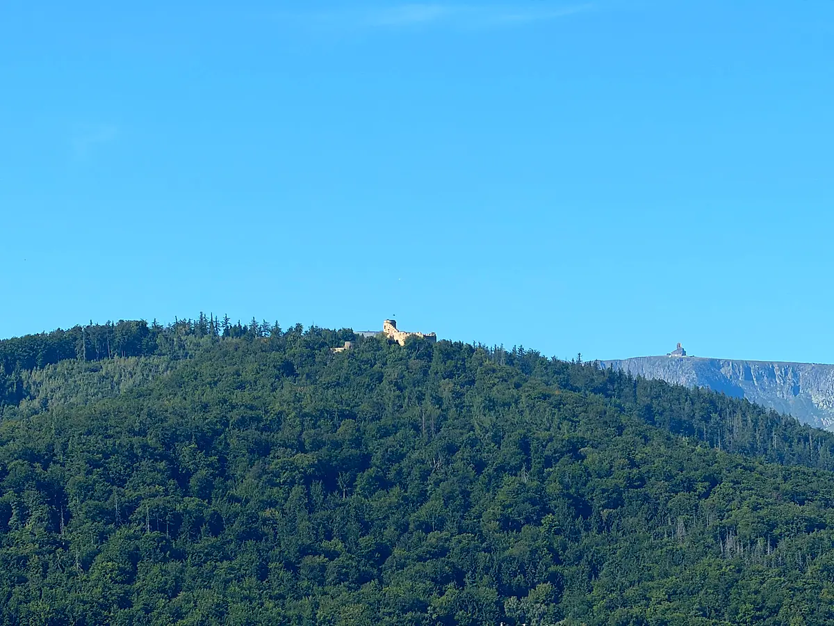
The view from the dam crest: a wooded hill with the ruins of Chojnik Castle, and the Karkonosze ridge with Śnieżka in the distance on the right
Chojnik Castle in the foreground, the main Karkonosze ridge behind it. This is the view you climb onto the dam crest for.
A panorama from the dam: the ruins of Chojnik Castle on its hill to the left, the wall of the Śnieżne Kotły cirques and Śnieżka to the right
The same view in a wider frame – from Chojnik to the ridge above the Śnieżne Kotły.
A wooden bench in tall grass, fields and the Karkonosze ridge with Śnieżka behind it
The bench where the oak and maple avenue begins. The view takes in the whole ridge with Śnieżka.
The historic oak and maple avenue: a dirt track between two rows of old trees whose crowns close overhead
The avenue has 135 trees and is a protected natural monument. The shade holds even on a hot day.
A white gazebo with a shingled roof on a bank above the pond in the Norwegian Park, a fountain playing on the water
The gazebo above the pond in the Norwegian Park, on the way back round the loop.
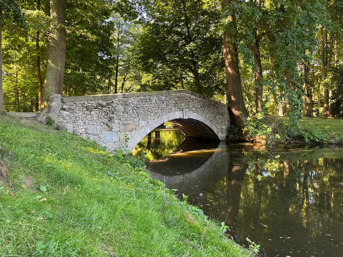
A single-arch stone bridge over water in the Norwegian Park, old trees around, the arch reflected in the water
The stone bridge in the Norwegian Park – one of the places where the trail leaves the paths for the waterside.
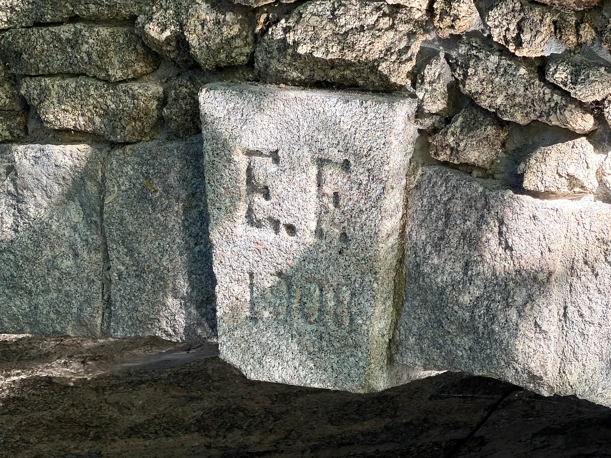
The granite keystone in the arch of the bridge with the carved initials E.F. and a worn date below
The keystone of the arch: the initials E.F. and the year 1908. The park was laid out from 1906 by Eugen Füllner, owner of the Cieplice paper machine works – and no other E.F. comes to mind here. You cannot see it from the path; you have to go down to the water and look under the arch.

Map of the loop

The green line is the recorded track – the same one the app follows. The arrows show the direction the spoken directions are laid out in. Click a marker to see what it is.

Frequently asked questions

How long is the Cieplice green walking loop?

6.41 kilometres, measured from the GPS track of an actual walk. It is a circuit, so you join it wherever you like and come back to the same spot – no return transport needed. At an easy pace it takes about 1 hour 40 minutes.

How is the green trail different from the red one?

The red loop of the Main Cieplice Walking Trail is 10.65 km and climbs the hills – Sołtysia, Chmielnik, Morskie Oko. The green loop is half as long and practically flat: 37 metres of ascent in total, because it stays on the valley floor, in the parks and on the embankment.

Can I walk it with a pram?

Yes, with one small detour. Steps lead up onto the flood embankment, but they can be bypassed. Otherwise the route follows park paths, field tracks and pavements, with no climbing.

Where can I park?

Easiest around Plac Piastowski in Cieplice – a convenient way onto the loop, with city buses stopping there. Since it is a circuit, you can just as well join it by the Norwegian Park or from the embankment.

Is this the same green trail as the one to the Grave of the Unknown Priest?

No. These are two different routes with the same white-and-green waymark. This one is a loop around Cieplice; the other climbs from Poprzeczna street to the grave in the forest above Staniszów and is 2.1 km long. They lie several kilometres apart.